Posts

Showing posts from January, 2024

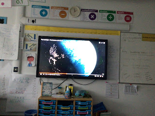
I can explain why some parts of Scandinavia have 24 hours of darkness.

Image
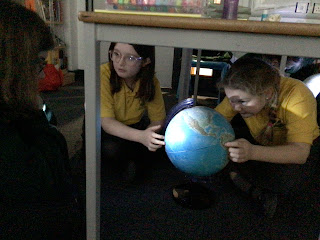
This week the children used globes to identify how the tilt of the Earth has an effect on the amount of light/ darkness in Northernmost part of Norway and Sweden which are north of the Arctic Circle. The polar nights lasts for about 28 days and the midnight sun can last for 50 days.  The Earth is on an axis - 23.5 degrees. Which means that when the Earth is tilted away from the sun, there are parts of the northernmost points that do not receive any sun for parts. When the Earth is tilted towards the sun the northernmost points will receive sun most of the time.  This was quite a tricky concept to learn so the children used torches and a globe to act out how the tilt has an effect of the Earth.

What are time zones?

Image
This week, the children were introduced to time zones. They talked about how they have family in different parts of the world and they need to think about the time difference when they ring them. They recapped how the world rotates around the sun to make day and night and how the times will be different in the world. Then the children used a time zone map to identify the different lines of longitude which split the world into different time zones. The Prime Meridian is where the time zones begins, this means that the countries to the east of us will be ahead of us (in time). Whereas, the countries to the west of us will be behind us in time.  To consolidate their learning, the children used live links to compare what is happening in different parts of the world. 

Another busy week in year 5 - 22/1/2024 - 26/1/2024

Image
 This week the children have honed their division skills in maths. In English, they have begun to play with and use relative clauses and parenthesis, which they are now able to use, in their writing. F1 is becoming more real as the children are just about to start writing their speeches and practice their presentations which they will present in two weeks time. In Geography, they looked at time zones and how they work.  Well done to the four boys who attended a maths challenge in Ryde, they were great ambassadors for the school. 

I am beginning to recognise the climate of Scandinavia according to its location on a map.

Image
This week the children looked at a climate graph for London, Umea and Copenhagen. They began to discuss the climates of each country as well as recapping what climate means.  They were then introduced to the Arctic Circle and a Birds Eye view of the Arctic Circle and the continents that can be found there. The children then used their atlas to label continents and oceans in the area and discuss their climate. 

This week in school 15/1/2024

Image
 We have had a great week this week, looking at how writers use suspense in their writing. In maths, we have honed our skills multiplying 2 digits by a 2 digit number. begun dividing four digit numbers and in Science, DT and Computing we have carried on with our F1 Challenge. 

What is the physical geography of Scandinavia?

Image
This week the children used photos from Norway, Sweden and Denmark to identify the physical features of these countries. The children identified that Norway was very mountainous with lots of waterfalls. There are fjords, rivers and glaciers. One of the adults in the room showed us her photo of her near a glacier and a child shared their experience when they visited Norway .  Sweden has mountains to the west and rivers. It also has some fjords as well as lots of dense forests. Sweden has the third largest lake in Europe:Mount Vanern.  Denmark is completely flat with some rolling hills. It is so flat that it often floods. It is made up from lots of islands. Denmark has lots of coastal areas and many beaches. Finally, the class looked at the Northern Lights and how these are formed. Some of the children believe they saw these in Freshwater about a month ago. 

What is Scandinavia?

Image
 This term, the children will be studying Scandinavia. Here is a copy of their journey.  The first lesson recapped the different lines of latitude and longitude as well as the four hemispheres. The children then located the continents and oceans before identifying the three countries that make up Scandinavia: Norway, Sweden and Denmark. One of the children through Iceland and Sweden were part of Scandinavia, these countries are part of the Nordic Countries. Finally the children compared the three flags and how they were similar to each other.