Posts

Showing posts from September, 2023

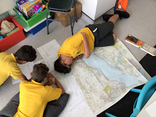
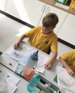
What is in our area?

Image
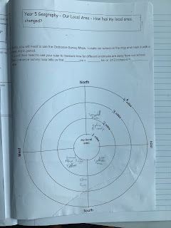
 This week, the children used Ordnance Survey Maps to see what different places of interest they could find in the Cowes area.The children looked at the scale of the map: 1:25,00, which means that 1cm on the map represents 250 metres on the ground. The children then used this information to see what was in their local area and further afield. 

Welcome meetings

 It was lovely to meet everybody this afternoon. For those of you who could not make the meeting, please find attached the link to the PowerPoint we talked through.  The only thing that wasn't included is the residential in July as we need to finalise the dates and travel but we will let you know about this shortly.  Have a great weekend.  Year 5 team. https://docs.google.com/presentation/d/12UUNpKV9_g2eolK1JjRJdnBLg6fpBMCwuDplab8iPbE/edit#slide=id.gf0dcaa84e4_0_169

Picture gallery

Image
 

Can you find the 4 grid reference for your house ?

Image
As we had to cancel our fieldwork trip due to the thunder and lightning, the children used Ordnance Survey Maps to find places in Cowes. First, they identified the symbols on a map and then they used the 4 grid references to find symbols, roads and places of interest on the map. 

Here is this week’s picture gallery.

Image
 

Human and Physical Geography

Image
 This week the children compared three maps of Cowes. One map was from 1890, another from 1950 and 2021. The children discussed the differences between the maps. One was black and w note which confused some children. They then identified the human and physical geography that had changed since 1890. At the end of the lesson they were then asked what a map of Cowes would look like in 2050. 

Our first week back.

Image
All the children have settled back into school and are working hard despite the extremely hot weather. Both teachers have had a fabulous first week getting to know their classes and are looking forward to an amazing year.